Trail Details
The Trailway is part of the Blue Route provincial cycling network.
Trailheads: There are over thirty trailheads and access points. For location and GPS coordinates visit the Celtic Shores Coastal Trail website (www.celticshores.ca).
Surface: Most of the trail is smooth and hard-packed. (Upgrading yearly)
Cycling Speed: 20 km/hr (12 miles/hr)
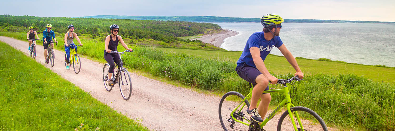
The trail grade is almost flat with very few slight inclines. Hybrid or mountain bikes are best suited for this trail. Other uses include hiking, snowmobiling, cross country skiing, ATVing, equestrian, geocaching.
Trail Rules and Etiquette
The Celtic Shores Coastal Trail is a shared use trail that is operational year round. Please use the trail responsibly. Expect to see the following users on the trail: cyclists, hikers, walkers, equestrians and summer motorized. In winter you will find people snowshoeing, cross country skiing, hiking, and snowmobiling.
- Please respect the trail and other users
- Please pick up after your pet
- Pets must be on a leash
- Leave No Trace – Take Only Memories
- Maximum trail speed 30 Km – unless posted less
- All wheels yield to all heals
- Obey all posted signs
- No littering “Pack It In-Pack It Out”
- No hunting or trapping
- No unauthorized vehicles on trail
- Travel right side of trail & pass on left
- Announce approach well in advance
Some Highlights Along the Trail:
- Watch for pilot whales, bald eagles and a variety of sea birds as you enjoy the sweeping coastal views between Port Hastings and Long Point.
- Pack a picnic for the Troy Station trailhead or Christy’s Look-Off, both provide a rest stop overlooking St. George’s Bay.
- Join an afternoon ceilidh at the Celtic Music Interpretive Centre in Judique, with lunch, live music, and step dancing. They also offer guided tours along the Celtic Shores Coastal Trail.
- Relax in the warm salt waters of West Mabou Beach Provincial Park, Port Hood Station Provincial Beach, and Inverness Beach.
- Foot stomping Celtic music is always on tap at the Red Shoe Pub in Mabou.
- Try the signature Glen Breton Rare Single Malt Whisky during a guided tour at Glenora Inn and Distillery in Glenville.
- Play a round of golf at the renowned Cabot Links and Cabot Cliffs in Inverness.
- Get on the water with Eagle Eye Outfitters, who offers a variety of boat tours, as well as bike and kayak rentals.
- Discover the work of local artists at the Inverness County Centre for the Arts and take home a piece to remember your visit.
- Feel the thrill of Bluefin Tuna Sportfishing during a guided tour off the coasts of Port Hood, Mabou and Inverness.
Cyclists and low impact hikers please note: For best cycling and walking trail surface conditions it is recommended that you access the trail from Route 19 at the Troy Station, 5.6 km from the round-about/rotary. The first 2km of trail starting at the Canal offer spectacular scenery and a modest trail surface for hiking and sight seeing but recommend cyclists or low impact hikers exit the trail at that point. The next 5 km (between the Canal and Troy Station Trailhead) contain some sea-swept sections of the trail that have resulted in medium to difficult hiking and “hike a bike” trail surface conditions.